


MOUNT EVEREST(SAGARMATHA)
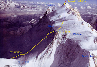
 Mount Everest or Sagarmātha is the world's highest mountain above sea level at 8,848 metres (29,029 ft). It is located in the Himalayas in Asia.
In 1856, the Great Trigonometric Survey of British India established the first published height of Everest, then known as Peak XV, at 29,002 ft (8,840 m). In 1865, Ev
 erest was given its official English name by the Royal Geographical Society upon recommendation of Andrew Waugh, the British Surveyor General of India at the time, who named it after his predecessor in the post, and former chief, Sir George Everest. Chomolangma had been in common use by Tibetans for centuries, but Waugh was unable to propose an established local name because Nepal and Tibet were closed to forgeins.
KANGCHENJUNGA
Kangchenjunga is the third highest mountain in the world (after Mount Everest and K2), with an elevation of 8,586 metres
 (28,169 ft). Kangchenjunga translated means "The Five Treasures of Snows", as it contains five peaks, four of them over 8,450 metres. The treasures represent the five repositories of God, which are gold, silver, gems, grain, and holy books. Kangchenjunga is called Sewalungma in the local Limbu language, translates as 'Mountain that we offer Greetings to'. Kanchenjunga or Sewalungma is considered sacred in the Kirant religion.
Three of the five peaks (main, central, and south) are on the border of Nor
 th Sikkim district of Sikkim, India and Taplejung District of Nepal, while the other two are completely in Taplejung District. Nepal is home to the Kanchenjunga Conservation Area Project run by the World Wildlife Fund in association with Government of Nepal.The sanctuary is home to the Red Panda and other montane animals, birds and plants. India's side of Kangchenjunga also has a protected park area called the Khangchendzonga National Park.
LHOTSE
Lhotse is the fourth highest mountain on Earth (after Mount Everest, K2 and Kangchenjunga) and is connected to Everest via the South Col. In addition to the main su
 mmit at 8,516 metres above sea level, Lhotse Middle (East) is 8,414 metres and Lhotse Shar is 8,383 metres. It is located at the border between Tibet (China) and the Khumbu region of Nepal.Lhotse is best known for its proximity to Mount Everest and the fact that climbers ascending the standard route on that peak spend some time on its northwest face; see below. In fact Lhotse has the smallest topographic prominence value of any official eight-thousander, as it rises only 610 m (2,000 ft) above the South Col. Hence it is often seen as a minor eight-thousander.
MAKALU
Makalu in Nepali , is the fifth highest mountain in the world and is loc
 ated 22 km (14 mi) east of Mount Everest, on the border between Nepal and China. One of the eight-thousanders, Makalu is an isolated peak whose shape is a four-sided pyramid.
Makalu has two notable subsidiary peaks. Kangchungtse, or Makalu II, 7,678 m (25,190 ft), lies about 3 km (2 mi) north-northwest of the main summit. Rising about 5 km (3.1 mi) north-northeast of the main summit across a broad plateau, and connected to Kangchungtse by a narrow, 7,200 m saddle, is Chomo Lonzo, 7,804 m (25,604 ft).
CHOOYU
Cho Oyu is the sixth highest mountain in the world at 8201 metres above sea level. Cho Oyu lies in the Himalayas and is 20 km west of Mount Everest, at the border b
 etween China and Nepal. Cho Oyu means "Turquoise Goddess" in Tibetan.
Cho Oyu was first attempted in 1952 by an expedition organised and financed by the Joint Himalayan Committee of Great Britain as preparation for an attempt on Mount Everest the following year. The expedition was led by Eric Shipton and included Tom Bourdillon, but technical difficulties at an ice cliff above 6,650 m (21,820 ft) proved beyond their abilities.
DHAULAGIRI

Dhaulagiri is the seventh highest mountain in the world. It forms the eastern anchor of the Dhaulagiri Himal, a subrange of the Himalaya in the Dhawalagiri Zone of north central Nepal. It lies northwest of Pokhara, an important regional town and tourist center. Across the deep gorge of the Kali Gandaki to the east lies the Annapurna Himal, home to Annapurna I, one of the other eight-thousanders. Dhaulagiri means "White Mountain".
MANASLU
Manaslu also known as Kutang, is the eighth highest mountain in the world, and is located in the Mansiri Himal, part of the Nepalese Himalayas, in the west-central
 part of Nepal. Its name, which means "Mountain of the Spirit", comes from the Sanskrit word Manasa, meaning "intellect" or "soul". Manaslu was first climbed on May 9, 1956 by Toshio Imanishi and Gyalzen Norbu, members of a Japanese expedition. It is said that "just as the British consider Everest their mountain, Manaslu has always been a Japanese mountain".
Manaslu at 8,156 metres (26,759 ft) above mean sea level (m.s.l) is the highest peak in the Lamjung District and is located about forty miles east of Annapurna. The mountain's long ridges and valley glaciers offer feasible approaches from all directions, and culminate in a peak that towers steeply above its surrounding landscape, and is a dominant feature when viewed from afar.
The Manaslu region offers a variety of trekking options. The popular Manaslu trekking route of 177 kilometres (110 mi), skirts the Manaslu massif over the pas
 s down to Annapurna. The Nepalese Government only permitted trekking of this circuit in 1991. The trekking trail follows an ancient salt-trading route along the Budhi Gandaki river. Enroute, 10 peaks over 6,500 metres (21,300 ft) are visible, including a few over 7,000 metres (23,000 ft). The highest point reached along the trek route is the Larkya La at an elevation of 5,235 metres (17,175 ft). As of May 2008, the mountain has been climbed 297 times with 53 fatalities.
Manaslu Conservation Area has been established with the primary objective of achieving conservation and sustainable management of the delimited area, which includes Manaslu.
ANNAPURNA
Annapurna is a series of peaks in the Himalayas, a 55 km (34 mi)-long massif of which the highest point, Annapurna I, stands at 8091m, making it the 10th-highest summit in the world and one of the 14 "eight-thousanders". It is located east of a great gorge cut through the Himalaya Mountains by the Kali Gandaki River, which separates it from the Dhaulagiri massif. (Dhaulagiri I lies 34 km west of Annapurna I.)

Annapurna is a Sanskrit name which literally means "full of food" (feminine form), but is normally translated as Goddess of the Harvests. In Hinduism, Annapurna is a Goddess of fertility and agriculture and an avatar of Durga.
The entire massif and surrounding area are protected within the 7,629 km2 Annapurna Conservation Area, the first and largest conservation area in Nepal, established in 1986 by the King Mahendra Trust for Nature Conservation. The Annapurna Conservation Area is home to several world-class treks, including the Annapurna Circuit.
The Annapurna peaks are the world's most dangerous mountains to climb, with a fatality to summit ratio of more than 40%.
In Nepal there are other many mountains.In the world ,Nepal is well known by those mountain's.But due globle warming the temp of the going increasing and the may melt,it's a disaster for Nepal and world because our ornament are going to collapse.That's why we should work to minimise globle warming.


0 comments:
Post a Comment