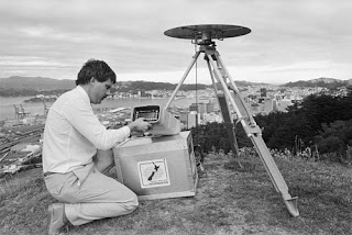
Surveying or land surveying is the technique and science of accurately determining the terrestrial or three-dimensional position of points and the distances and angles between them. These points are usually on the surface of the Earth, and they are often used to establish land maps and boundaries for ownership or governmental purposes.
To accomplish their objective, surveyors use elements of geometry, engineering, trigonometry, mathematics, physics, and law.
An alternative definition, per the American Congress on Surveying and Mapping (ACSM), is the science and art of making all essential measurements to determine the relative position of points and/or physical and cultural details above, on, or beneath the surface of the Earth, and to depict them in a usable form, or to establish the position of points and/or details.
Furthermore, as alluded to above, a particular type of surveying known as "land surveying" (also per ACSM) is the detailed study or inspection, as by gathering information through observations, measurements in the field, questionnaires, or research of legal instruments, and data analysis in the support of planning, designing, and establishi ng of property boundaries. It involves the re-establishment of cadastral surveys and land boundaries based on documents of record and historical evidence, as well as certifying surveys (as required by statute or local ordinance) of subdivision plats/maps, registered land surveys, judicial surveys, and space delineation. Land surveying can include associated services such as mapping and related data accumulation, construction layout surveys, precision measurements of length, angle, elevation, area, and volume, as well as horizontal and vertical control surveys, and the analysis and utilization of land survey data.
Surveying has been an essential element in the development of the human environment since the beginning of recorded history (about 5,000 years ago). It is required in the planning and execution of nearly every form of construction. Its most familiar modern uses are in the fields of transport, building and construction, communications, mapping, and the definition of legal boundaries for land ownership.
Surveying techniques
Historically, distances were measured using a variety of means, such as with chains having links of a known length, for instance a Gunter's chain, or measuring tapes made of steel or invar. To measure horizontal distances, these chains or tapes were pulled taut according to temperature, to reduce sagging and slack. Additionally, attempts to hold the measuring instrument level would be made. In instances of measuring up a slope, the surveyor might have to "break" (break chain) the measurement- use an increment less than the total length of the chain.Historically, horizontal angles were measured using a compass, which would provide a magnetic bearing, from which deflections could be measured. This type of instrument was later improved, with more carefully scribed discs providing better angular resolution, as well as through mounting telescopes with reticles for more-precise sighting atop the disc (see theodolite). Additionally, levels and calibrated circles allowing measurement of vertical angles were added, along with verniers for measurement to a fraction of a degree—such as with a turn-of-the-century transit.
The simplest method for measuring height is with an altimeter — basically a barometer — using air pressure as an indication of height. But surveying requires greater precision. A variety of means, such as precise levels (also known as differential leveling), have been developed to do this. With precise leveling, a series of measurements between two points are taken using an instrument and a measuring rod. Differentials in height between the measurements are added and subtracted in a series to derive the net difference in elevation between the two endpoints of the series. With the advent of the Global Positioning System (GPS), elevation can also be derived with sophisticated satellite receivers, but usually with somewhat less accuracy than with traditional precise leveling. However, the accuracies may be similar if the traditional leveling would have to be run over a long distance.
Triangulation is another method of horizontal location made almost obsolete by GPS. With the triangulation method, distances, elevations and directions between objects at great distance from one another can be determined. Since the early days of surveying, this was the primary method of determining accurate positions of objects for topographic maps of large areas. A surveyor first needs to know the horizontal distance between two of the objects. Then the height, distances and angular position of other objects can be derived, as long as they are visible from one of the original objects. High-accuracy transits or theodolites were used for this work, and angles between objects were measured repeatedly for increased accuracy.
|
|
|


1 comments:
Post a Comment